Model Description:
The region for this study covers Casco Bay and is closed by a curved outer boundary from Cape Elizabeth to Cape Small, close to the 80 m isobath. The surface area, excluding the 91 islands used here, is about 1200 km2 ( 463 square miles). The average depth within the study site is approximately 24 m. The deepest spot is 118 m located at about the center of the outer boundary.
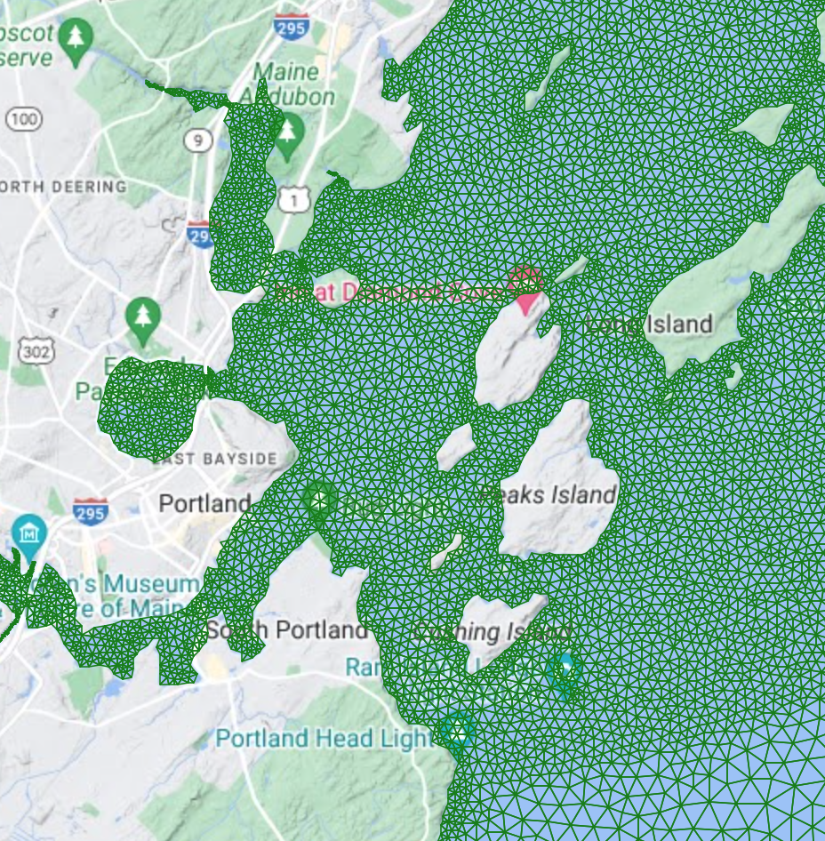
| For this study, the numerical model, Finite Volume Community Ocean Model (FVCOM) is applied to an unstructured triangular mesh. Click on the adjacent image to see the grid. FVCOM, developed by Chen et al. (2003), is a prognostic, unstructured grid, finite-volume, free surface, three dimensional primitive equation coast and estuarine model. The default setup applies the Mellor and Yamada (1982) level 2.5 turbulent model scheme for vertical mixing, and the Smagorinsky (1963) scheme for horizontal mixing. The vertical structure is represented with equally spaced terrain following sigma-levels. For more about FVCOM, see http://fvcom.smast.umassd.edu/ |
 |
|
The bay is represented by high resolution triangular unstructured meshes. Meshes of varying levels of resolution are used for different objectives. Mesh size can vary from 21,245 nodes and 38,762 triangles to 39,995 nodes and 72,566 triangles. The computational domain is enclosed by the outer boundary curve from Cape Elizabeth to Cape Small. The straight line distance from Cape Elizabeth to Cape Small is about 43 km. The vertical structure is usually represented by using 11 equally spaced levels at each nodal depth. The shoreline and islands are sampled with nodes at intervals of 150 m or less, and generally at intervals of 450 m along the outer boundary.
The data for the bottom topography comes from the National Geophysical Data Center (NGDC), an office of the National Oceanic and Atmospheric Administration (NOAA). That office developed an integrated topographic-bathymetric digital elevation model (DEM) of Casco Bay, Maine (DEM, 2008). This high resolution bathymetric data provides water depths on 10 m squares for all of Casco Bay.
References:
Chen, C., Liu, H., Beardsley, R., 2003. An unstructured grid, finite volume, three dimensional, primitive equations ocean model: Application to coastal ocean and estuaries. Journal of Atmospheric and Ocean Technology, 20(1), 159-186.
Mellor, G. L., Yamada, T., 1982. Development of a turbulence closure model for geophysical fluid problems. Reviews Geophysics Space Physics 20, 851-875.
Smagorinsky, J. 1963. General circulation experiments with the primitive equations. Monthly Weather Reviews 91, 99-164.